The most recent provincewide snowpack bulletin shows the whole of B.C. in dire straits, with Vancouver Island worse off than almost anywhere else.
But River Forecast Centre hydrologist Jonathan Boyd says it isn’t time to panic just yet, and the current state of the Island’s snowpack isn’t that uncommon.
“But yeah, it’s not a great situation,” he said in an interview.
Vancouver Island currently has just 30 per cent of its usual snowpack as B.C. hosts 61 per cent of its normal level. This is measured at five stations around the Island, with three of them currently showing no snow at all.
While this sounds extreme, it’s not totally unheard of for those stations to have zero snow. Boyd said it has happened several times before, which is why he values the results at the other two stations more.
“If they had been at their record low, it would have been more meaningful,” he said.
Considering all that, Boyd said the Island is at about a 10-year low, with the last similar year being 2015. That year had less of a snowpack at the start of February than we do now, and never really bounced back. The result was extreme fire danger and extended watering bans.
Still, similar snowpacks have been seen in February and eventually recovered. Boyd pointed to 2014 when the Feb. 1 snowpack was worse than what it is now, though by May 1 it was at a near-normal level.
“There still is time for improvement and recovery,” he said.
That being said, Boyd conceded the El Nino pattern this year makes a rebound less likely. Low snowpack and warm temperatures in 2015 were also linked to El Nino-influenced weather patterns.
“We are getting these warmer winters and springs with El Niño,” Boyd said.
Compounding the issues, the Island experienced an extended drought last year due to early snowmelt and hot summer.
“My fear is that we might end up in a situation where we melt even earlier than last year,” Boyd said.
The Feb. 8 bulletin — which was based on the levels as of Feb. 1 — does say the low snowpack is expected to persist across the province, noting that Environment and Climate Change Canada predicts there is a 60 to 100 per cent chance of the above average temperatures continuing through April.
Boyd said the amount of snow that falls on the Island can also vary widely depending on very small temperature changes. This was abundantly clear in January, as Vancouver Island got hit with plentiful moisture, but little of that fell as snow.
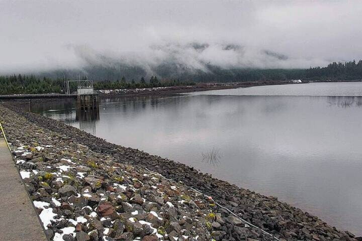
Because it is already generally a warmer and rainier climate, the snowpack should ultimately have less of an effect on the southern portion of the island, and Boyd says the Sooke Lake Reservoir is currently full after January’s atmospheric rivers.
“Victoria is quite unique, where it doesn’t necessarily rely on the snowpack because it’s a fairly low elevation watershed,” Boyd said. “It’s really the fall and winter rains that replenish that particular area.”
But the impact could be felt up Island if things don’t change.
“The systems that rely on that snowpack are going to have more of a challenge potentially, if we don’t catch up,” Boyd said.
He expects this to mean a difficult wildfire season across the province, though there is a bit more uncertainty on the Island as the rainforest can be a bit more resilient to dry spells.
“Drought and wildfire tend to go hand in hand,” Boyd said.
Another potential impact is the effect on salmon-bearing streams. The fish must be able to safely reach spawning grounds in smaller creeks to reproduce.
“It’s not necessarily just the low levels of the creeks that are the concern, it becomes the temperature of the creeks,” Boyd said. “It can get so warm that it’s fatal for the fish.”
Because the low snowpack is linked to the El Nino weather patterns, it is hard for Boyd to say if the culprit is climate change.
Long-term, it may not always mean a low snowpack, but might cause earlier and earlier melt.
“And having snow melt maybe in April or early May on a more consistent basis,” he said.
READ MORE: B.C.’s snowpack is 39% below normal levels